| Basic Information
This site will provide information on the physical and environmental feature of the area including locational, topographical, climatic, bathymetry and geomorphological information.
| Location
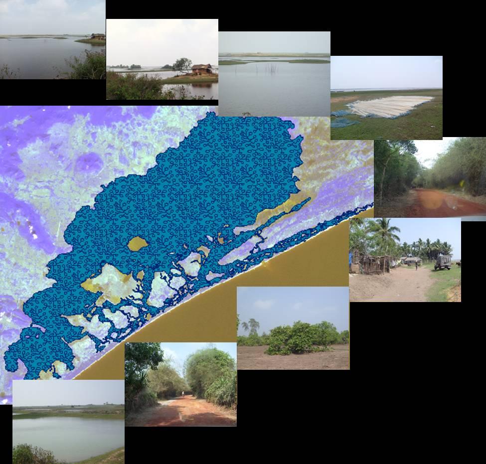
Chilika Lake in Orissa, India, is one of the largest brackish water ecosystems in south-east Asia. It is situated along the east coast of India and is well known for its rich fisheries resources and is considered to be an important biological asset of the country. It is both a part of Orissa’s heritage and is known for its beauty world-wide. Its birds and fish have been attracting human attention for a very long time.
| Geographic Position
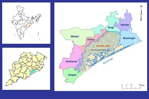
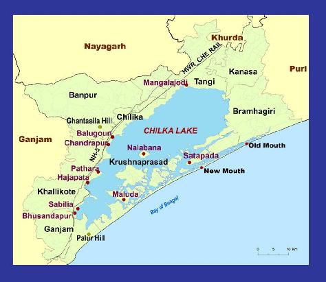
This pear shaped lake is situated on the east coast of Indian sub-continent and is connected with the Bay of Bengal. The Lake is situated between 19 ° 28' and 19 ° 54' north latitudes 85 ° 05' and 85 ° 38' east longitudes, covering an area of 1165 sq. km, with an average length of about 64 km and an average width of 13.5 km. Puri, Khurda and Ganjam districts of Orissa surround the lake. The main axis of the lake is from southwest to northeast. It is parallel to the coastline, having a maximum width in the Puri and Khurda Districts. It is bordered by the Eastern Ghats, National Highway No-5 and Howrah-Chennaie Railway line on its western side and the Bay of Bengal on its eastern side. Major towns that lie near the lake area are Balugaon, Chilika, Khalikote, Rambha and Ganjam (Fig).
| Topography
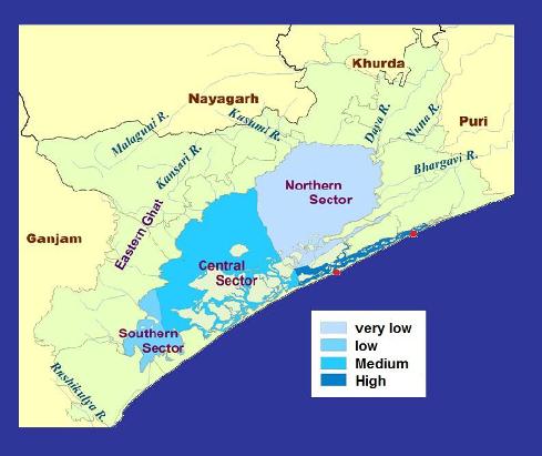
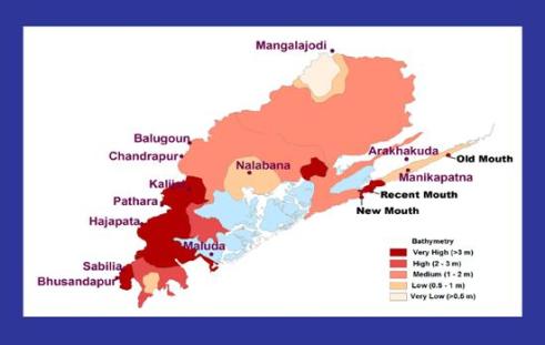
Chilika Lake has an area of approximately 906 sq km in summer and 1,165 sq km in the rainy seasons. A 35 km long channel, called the outer channel, connects it with the sea. It receives fresh water from the river Daya, one of the deltaic branches of the river Mahanadi, and from several small local streams and channels (nalas). At the western side, the lake is embraced by a group of hillocks – a portion of the Eastern Ghats, locally known as Dipa Mundia, Kalijugeswara, Manmu Bhanaja, Solari, Bhaleri, Jatia and Ghantasila. The lake has been divided into four natural sectors based on salinity and depth (Fig): the Northern Sector, Southern Sector, Central Area and Outer Channel.
The northern sector is the widest portion of the lake, whose average width is near 15 km. There is a significant inflow of water into the lake in the rainy season through the Daya and Bhargavi rivers along this side of the lake. As these two rivers continuously deliver sediment into the lake from the uplands, this part of the lake has been comparatively silted-up. The average depth of the lake in this region varies from 0.5 to 1 meter, increasing to 1.5 to 2 meters during the rainy season. The southern sector has a narrow stretch, the width of which varies from 3 to 5 meters in summer. In the dry season, when the water level is at its lowest, its depth rarely exceeds 2.5 meters. In the summer, the deepest portion of the lake is around the Kalijai hills. Here, the average depth is 3 meters in summer (Fig).
| Geomorphology
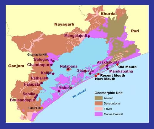
The major geomorphic units of the lake are classified as Denudational, Marine / Coastal, Fluvial and Aeolian (Fig). Denudational hills and inselbergs are present along the southwest and western part of the lagoon. They are mostly comprised of Khondalites and Gneissic-rocks of the Eastern Ghats. They project as promontories into the lake. The low denudational hills and rolling plains are covered by laterites. To the southwest of Chilika Lake, the denudational hills cover the most of the area.
|