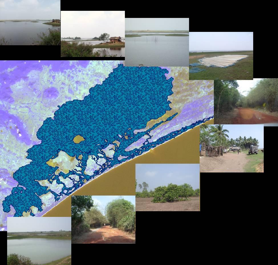
| Chilika Lake
Chilika Lake is situated on the eastern coast of Orissa, and is Asia’s largest brackish water lake with estuarine characteristics; it is a rich source of many natural resources. The complex mix of resources in and around the lake has a strong influence upon communities who live near it because they modify their lifestyles and livelihood earning systems depending upon the resources types and availability. Thus, the sustainable development of Chilika Lake depends upon strengthening of these local communities who can protect the natural coastal resources by their cooperation and effective participation in the management process. This cooperation and participation may be best achieved by means of working with the village management committees that operate in this area as these management committees, due to their intimate knowledge of the local circumstances can work to convince local people of the need for resource protection; their suggestions are also more likely to be favorably received than those of outsiders.
Natural resource development and management is the current key topic for local development. Proper management of the natural resource base of the Chilika Lake may tend to the sustainability of the resources as well as it can influence the local people of the region which can be achieved if the access to the proper and up-to-date database is available to the planner and PPGIS (Public Participatory GIS) can be successfully implemented for the sustainable resource management. For the said reason it is essential to consider several key aspects like observing present condition of the resources, peoples’ perception and attitude, present planning policies etc.
Accessibility to accurate information like topographic maps, aerial photos, satellite images and Geographic Information Systems (GIS) at the national as well as local level is one means through which the existing resource potentials of the area can be identified.Thus, this is our basic attempt to develop a database by using these advanced technologies, which will help to manage natural resources so as to achieve a balance between their functions for the quality of the environment and their functions for the quality of human life.
| Accessing the Database (CRID)
Main objective of this Chilika Resource Information Database (CRID) is to support the designing and implementation of management plans in the area by taking into account all the related impact of the management process on the local environment and livelihood. This information database will provide a flexible environment in which both the public as well as the stakeholders can customize and maintain their own update information and can use for their specific needs. This Information Database will facilitate storage, retrieval, updating,analysis and manipulation of coastal resource information. This will also facilitate the sharing of coastal resource data within and between the regions.
| Overview of the Database
This database information will constitute basically two major parts which are; a database providing information and monitoring features and a simple set of software interface which will provide users with basic querying, updating and reporting capabilities. In each block of the area a Kiosk will be establish where the volunteers will guide the general public to operate that information system with little or even no computer knowledge. As the database will be in the public domain everybody; the general public (local people including fishermen, non fishermen), stakeholder, government and non-government people can access with ease and can edit and modify the data in the database.
|